
Read Athens ZIP Coverage
USPS groups four codes under Athens, but they do different work. One is the principal street-delivery code and another serves post-office boxes and institutional mail. The other two reach growth and rural delivery areas while also including documented parcels inside the city. That is why an Athens ZIP code directory should describe roles and verified examples, not draw an invented postal boundary.
| ZIP | Verified area or role | Postal point | Research note |
|---|---|---|---|
| 35611 | Principal Athens street delivery; downtown and west-central role verified | Athens Post Office, 1110 W. Market Street | City Hall's physical address uses this code |
| 35612 | Post-office boxes and institutional mail | Boxes routed through the Athens facility | City government uses this code for its PO Box |
| 35613 | East and southeast growth corridor | Athens routing | Official records show incorporated parcels in this code |
| 35614 | North and rural Athens delivery | Athens routing | Official records also show city parcels here |
The evidence does not supply official ZIP polygons, complete neighborhood lists, split dates, or population totals by code. Those gaps should stay visible. A postal city name is a routing label, not proof of Athens jurisdiction.
Athens ZIP Code 35611
Code 35611 is the principal street-delivery ZIP in the documented Athens postal group. The USPS Athens facility stands at 1110 W. Market Street, Athens, AL 35611-2466. It provides carrier service, general delivery, and post-office boxes, and its published phone is 256-232-1100. That facility record is the clearest official anchor for the main delivery code.
The USPS facility source appears in the captured image below:
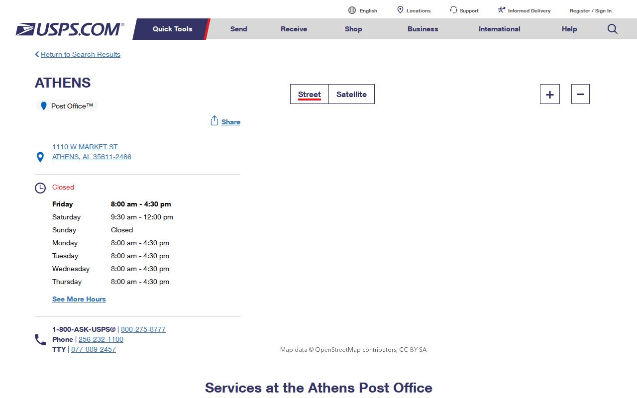
The capture ties the code to an official postal location, but it should not be read as a map of every address assigned to 35611.
City Hall supplies a useful physical example. Its street site is 200 W. Hobbs Street, 35611. For a property or permit search, that physical address is the useful key. A mailing address may point somewhere else, as the next code shows. This difference is normal and becomes crucial when a resident search starts from a letterhead or old envelope instead of the place itself.
Athens ZIP Code 35612
Code 35612 is the post-office-box and institutional-mail part of the Athens postal family. The city illustrates the split well. Athens City Hall is physically in 35611, while official city mail goes to PO Box 1089, Athens, AL 35612. A record showing 35612 can therefore identify a mail destination without identifying a physical parcel.
This is the strongest local quirk in the Athens postal directory. A box number cannot be placed on the parcel map as if it were a residence. Instead, keep the recipient name and box as mailing evidence, then locate a separate situs address in the underlying record. Situs is the physical location of a property. The county parcel layer publishes separate property and mailing fields for exactly this reason.
Limestone 9-1-1 also receives mail at PO Box 1111 in Athens 35612. Its documented contact can help route an addressing question, but the cited research does not state the agency's full assignment process. The safe claim is limited: the code supports box mail, not a mapped residential district.
Note: A 35612 mailing clue should never be converted into a home location unless a separate official record supplies the physical address.
Athens ZIP Codes 35613 and 35614
The other two codes show why ZIP geography and city limits must be kept apart. Official city records establish incorporated Athens property in both 35613 and 35614. Code 35613 serves the east and southeast growth corridor, with documented parcels around Shinnecock Hills and U.S. 72 and evidence in the Canebrake corridor. Code 35614 has a north and rural delivery role, yet the records also show incorporated parcels there, including an Airfield Street example.
Those examples prove overlap, not a complete border. No authoritative postal polygon map was found, and no source supports assigning every named neighborhood to one code. Athens grew quickly, with its July 2025 city GIS layer measuring 42.15 square miles. Annexed land, postal routes, and legal parcels must therefore be checked as separate layers.
The official Athens GIS maps and data page explains the city-limit and zoning resources. County parcel records can then verify the physical ZIP recorded for a specific site. Together they show whether a 35613 or 35614 parcel is inside Athens without pretending that the code itself defines the city.
Find Athens Residents by ZIP Code
No official local portal was verified as a public, ZIP-wide resident browser. The Athens postal workflow must use known records instead. Begin with a valid postal clue, confirm the specific property, and only then use the public roll that fits the research question. This avoids sweeping claims about everyone in a code.
- Confirm the address and postal code through the official USPS tools or the published facility record. Decide whether it is a street address or a post-office box.
- Search Limestone County Revenue Citizen Access by the property address. Capture the owner, parcel number, property ZIP, separate mailing ZIP, and legal references.
- Open the county parcel viewer to place that parcel among nearby sites. Use the city GIS layer when Athens jurisdiction matters.
- For a lawful voter-data need, use the individual state tool or request a voter list with the needed county or city scope, status, fields, format, and sort choice.
- Once the ZIP narrows the area, move to the Athens street directory for the address-to-parcel and deed workflow.
The Revenue search exposes entry points for Name, Parcel Number, and Address. Its published parcel schema contains separate property and mailing city, state, and ZIP fields, but a public ZIP-wide filter was not verified. Search addresses one at a time rather than promising a feature the interface has not documented.
Athens ZIP Directory Record Paths
A ZIP becomes useful only when paired with a record that has a clear custodian. Property fields are free through Revenue and GIS. Recorded deeds come from the Limestone County Judge of Probate. Voter lists are requested under state law, while municipal limits and annexation instruments answer whether Athens city offices should hold a site record. Each channel has a distinct scope.
| ZIP-linked clue | Best official route | What it establishes | Limit |
|---|---|---|---|
| Street-delivery code | USPS lookup or facility record | Postal routing for the entered address | Not a municipal boundary |
| Property ZIP | Revenue Citizen Access | Situs ZIP tied to a parcel | Owner is not necessarily an occupant |
| Mailing ZIP | County parcel record | Owner or tax-contact destination | May differ from the property |
| Registration address | Alabama voter channel | Available field in a requested list | Fees, status, and protected entries apply |
| City jurisdiction | Athens GIS and annexation records | Whether the parcel lies within city limits | Must be checked for the relevant date |
The Alabama voter-list request can specify county, city, or district; active, inactive, or both; delivery by mail, email, or pickup; and Excel or tab-delimited output. The form offers address and other selectable fields. Electronic copies cost one cent per voter, while printed copies cost $1 per page. The individual My Voter Page should not be described as a ZIP browsing tool because its interactive fields were not verified.
Athens Postal Directory Terms
Postal and parcel systems use the word “address” in different ways. A clean search keeps each term attached to the system that created it. That prevents a post-office box from becoming a made-up point on a map, and it keeps a broad delivery code from becoming an invented neighborhood line.
- ZIP code
- A five-digit USPS routing code. It organizes delivery and does not define the legal limits of Athens.
- ZIP+4
- The five-digit code plus four more digits that narrow mail routing to a smaller delivery segment.
- PO-box ZIP
- A code used for mail collected through post-office boxes rather than a mapped residential area. Athens 35612 fills that role.
- Unique ZIP
- A code assigned to one high-volume organization. The research did not verify a unique ZIP for Athens.
- Carrier route
- A delivery path served by a postal carrier. It is a mail operation unit, not a city boundary.
The legal description is a separate land-record tool. It preserves a parcel's identity through annexation, replatting, and some address changes. When a ZIP clue conflicts with a city label, lot, block, subdivision, plat, and book/page can supply the stable bridge.
Athens ZIP Codes and City Limits
ZIP boundaries serve mail. Athens city limits determine municipal jurisdiction. County lines govern county offices. These layers overlap, but they are not interchangeable. A property can carry an Athens mailing name outside the city, and the records prove that city parcels also occur in codes with rural or growth-corridor roles. The correct answer comes from the parcel and the city-limit layer, not from the last line of an envelope.
Use county GIS for the parcel, then turn to city mapping for Athens limits and zoning. If the current map and an older record differ, retrieve the annexation ordinance. These ordinances include legal descriptions and maps and are recorded with Probate. They can establish when a parcel entered city jurisdiction. The date matters because a city department may have no record from the period before annexation.
Boundary check. Treat every Athens postal label as a routing clue until the parcel map and city-limit layer confirm jurisdiction.
The city GIS release dated July 30, 2025 measured Athens at 42.15 square miles. It offers a current official snapshot, not a timeless border. Growth and annexation make date-specific confirmation essential for any permit, code, or municipal-record search.
Resolve Athens ZIP Code Conflicts
A conflict usually starts with two addresses that serve two valid purposes. City Hall's 35611 street address and 35612 mailing box are the plain local example. Parcel data can show the same split through separate PropertyAddr and MailAddress fields. Neither entry should overwrite the other. Record which one is situs and which one is mailing, then choose the right key for the next search.
For permits, zoning, or a physical site, use the situs address and parcel. For correspondence with an owner or office, use the stated mailing address. For deeds, rely on the legal description and recording references. If a rural route became a street address or a subdivision was replatted, search the plat and annexation record rather than assuming a citywide conversion. No official Athens-wide renumbering year was verified.
Some useful ZIP facts remain unknown. The research did not establish official postal polygons, a realignment chronology, full neighborhood coverage, per-ZIP population, or a public local portal that filters all residents by ZIP. A sound Athens postal directory says so. It narrows the search with verified postal roles, then lets parcel, voter, deed, and city records speak within their own limits.
Note: A ZIP result is a starting point for official record work, not proof that any named person currently lives inside that postal area.