
Athens Neighbor Records by Source
The immediate area around an Athens address is best read in layers. The county parcel viewer supplies adjacency and titled ownership. City GIS adds municipal and zoning context. Requested voter data and recorded deeds can confirm narrower facts, while historic districts explain when a block took shape. Each source has a firm boundary.
| Source | What It Shows About a Block | Access |
|---|---|---|
| County parcel viewer | Adjacent parcel shapes, titled owners, and tax attributes | Free visual viewer |
| City GIS | City limits, zoning, historic geography, and aerial context | Free map; some data packages cost |
| Revenue property roll | Owner, mailing and situs fields, parcel, and legal references | Free Citizen Access |
| Requested voter list | Available registrations and residence fields near the block | Statutory request, fee, protected limits |
| Probate and Archives | Older adjoining owners, deeds, plats, and local records | Portal, office, free index, or copies |
| Historic districts | Development era and place context | Public description, no resident roster |
| Associations | No official Athens member directory was verified | Do not assume public access |
A parcel record proves title, not a household. Relatives, guests, and other non-owner occupants do not appear simply because the map labels one owner. Treat the block view as a starting frame for nearby residents, then verify only the fact needed.
Map an Athens Block Parcel by Parcel
Begin with the Limestone County Parcel Viewer. Locate the target address, zoom to the block, and click the polygons that touch it or sit directly across the road. The underlying county service supports extent, centroid, distance, order, and pagination queries, but no labeled public buffer or radius button was verified. Pan, zoom, and click are the reliable public method.
- Find the known address and confirm that the selected polygon matches its property address.
- Click the parcels beside, behind, and across from it, then note each parcel number and titled owner.
- Open the property roll for separate situs, tax mailing, subdivision, lot, block, and deed references.
- Use the city layer when jurisdiction, zoning, or district context matters.
- For a complete named-road search, move to the Athens street directory workflow.
The flow is simple: address to parcel, parcel to adjacent polygons, polygons to owner names, and owner names to the narrow record that can confirm the next fact. Do not add an unverified occupant to that chain.
Athens Parcel Labels Are Not People
The county parcel schema separates OwnerName and OwnerName2 from the property and tax-mail fields. PropertyAddr is the situs, meaning the place where the parcel sits. MailAddress is where the owner or tax contact receives mail. If those addresses match, that is still not documented proof that the owner lives there. If they differ, the difference does not identify any other occupant.
Parcel data can also show neighborhood, assessment class, subdivision, municipality code, acreage, values, and deed book and page references. These help make sure two similar names or streets are not being confused. They do not publish utility customers, delivery accounts, every family member, or a complete block directory.
Local numbers reinforce that caution. Census data reports 11,251 Athens households, with 2.52 people per household and a 64 percent owner-occupied rate for 2020 through 2024. A parcel-owner map can therefore illuminate much of a block while still leaving a substantial share of its occupants unnamed. The numbers describe the city as a whole, not any one address.
Key distinction. Limestone GIS identifies titled owners and parcels. It is not a verified list of all local residents or households.
Athens Neighbor Maps and City Limits
A postal Athens address does not settle city jurisdiction. County parcel coverage extends beyond incorporated Athens, while the city's map adds its municipal limit and zoning. In the Athens GIS map resources, the city instructs users to turn on the Athens Zoning layer. The city-limit data released July 30, 2025 measured 42.15 square miles. Annexation ordinances and recorded legal descriptions provide the stronger evidence when the edge is unclear.
The same map resources list historic aerials for 2005, 2009, 2013, 2016, 2020, and 2025. Those images can show site change, but not who lived there. PLSS grid and flood layers add land context. A block outside the city limit still falls within county parcel coverage, so nearby addresses may share postal routing without sharing city services or zoning.
Note: Check parcel, municipal-limit, and postal facts separately because all three can describe the same address in different ways.
Athens Neighbor Voter List Limits
Alabama's individual My Voter Page is a personal status and polling-place tool. It was not verified as a block-browse feature. A full voter-list request under Ala. Code §17-4-38 is separate. It can select a county, city, or district; active, inactive, or both; delivery method; Excel or tab-delimited files; and an available set of name, residence, mailing, registration, election-history, precinct, ward, and district fields.
Electronic delivery costs one cent per voter. Printed lists cost $1 per page. Alabama does not register voters by party, and participation history never reveals ballot choices. Specified judicial, public-safety, and legislative officials and spouses may use protected-voter rules. Applications themselves are not open merely because some compiled list fields may be ordered.
A requested list may support a limited check of registrations tied to nearby addresses. It remains an incomplete picture of the block. Children, unregistered adults, protected people, recent movers, and other occupants may be missing. Inactive status also needs care.
Athens Blocks Across Three Districts
Historic geography changes how a block should be researched. The Athens State district centers on a campus core built from 1842 through 1924. Robert Beaty combines antebellum, postwar, and early twentieth-century homes. George Houston began with antebellum estates, then gained an 1898 fairground and racetrack subdivision and post-1908 Fairview development.
These eras point to different evidence. Sanborn maps help with the older core. Plats and recorded deeds fit Fairview and later subdivisions. White pages, sparse verified directory years, newspapers, and public census records add dated name clues. The Athens Historical Society preserves local history, but it does not publish a resident directory.
The George Houston story is especially useful. Two homes can stand on the same modern block yet come from different development phases. That is a reason to compare legal descriptions and plats before treating neighboring addresses as a single historical unit.
Athens Community Directories Have Gaps
No official Athens neighborhood-association or HOA umbrella directory was verified. No public HOA member roll was found. Community resources do exist, but their public purpose must not be stretched into a list of private residents. The city Historic Commission describes districts. The Chamber publishes organizations and business contacts. Houston Memorial Library & Museum offers local history access. None is a block roster.
Athens Historic Commission
District and preservation context. It does not identify current residents.
Athens Historical Society
City history research and preservation. No resident directory is published.
Houston Memorial Library
Local display and library access in a historic home, not a membership roll.
Community Eagle Watch
A police camera registry whose participant information is expressly confidential.
That last limit is decisive. Community Eagle Watch must never be portrayed as a tool for finding camera owners or local residents. Its public value is safety coordination with police, while participant details stay private.
Athens Records Versus Neighbor Tools
Official records and commercial neighbor tools serve different roles. A custodian states what an official parcel, deed, voter file, or map means. A commercial compilation may merge public filings with purchased data, then carry old or misattributed facts forward. It can be a lead, but not proof.
| Source Type | Useful For | Main Limit |
|---|---|---|
| County or city record | Parcel title, deed party, jurisdiction, zoning, or stated public field | Only the fact and date maintained by that custodian |
| Historical collection | A dated block, structure, newspaper, or directory clue | Snapshot coverage and gaps |
| Commercial compilation | A tentative lead to verify elsewhere | May be stale, merged, or wrongly assigned |
Use the current county record for title, the recorded instrument for a transfer, and the city map for municipal scope. Never repeat a compiled claim about block occupants until an appropriate official or historical source supports it.
Privacy Limits for Athens Neighbors
Public block research stops well short of a full people map. Alabama law protects listed personal identifiers and some contact information for covered officials and employees. Domestic-violence filings omit plaintiff and household addresses, phone numbers, and shelter locations. Ordinary motor-vehicle personal information is not a public directory. Utility and delivery customer lists were not documented as public Athens neighbor sources.
Offender information also has strict limits. The ALEA community registry guidance explains the state search and its legal cautions. The captured state page is shown here because it demonstrates that an official search has a defined purpose and cannot be treated as a general directory.
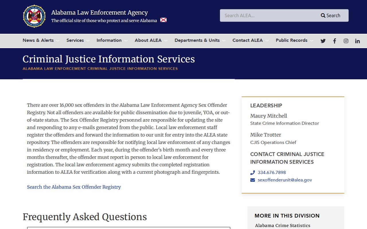
The registry warns against injury, harassment, or crime. It also says a listed conviction is not an individualized risk assessment, and some categories are not disseminated.
Lawful use. Learn about an Athens block for civic curiosity, history, or personal safety. Never use a map or name to watch, harass, intimidate, or harm anyone.